Al-Hasakah · Syrian Jazira · 3rd Millennium BCE

NabadaTell Beydar — The Buried City

35 kilometres northwest of Al-Hasakah, a circular 27-metre-high mound hides a 4,900-year-old city: palaces and temples, paved streets, and the oldest written texts in Syria.

2900BCE — city founded
600 mOuter wall diameter
5Temples in the city core
230Cuneiform tablets
17Excavation seasons (1992–2010)
▼ Scroll down
About the site

The “Wreath” City on Wadi Awaj

Tell Beydar is the modern name of ancient Nabada, mentioned in the Ebla archives. In the mid-3rd millennium BCE it was a regional centre of the kingdom of Nagar (Tell Brak).

The mound lies in the western Khabur Triangle at the crossing of two major routes: an east–west road from the Tigris to the Euphrates, and a north–south road toward the Diyarbakir plain. Rainfall here allows large-scale rain-fed farming — unlike irrigated southern Mesopotamia.

The tell belongs to the Kranzhügel (“wreath mound”, or “cup-and-saucer”) type: a 300 m central high mound ringed by an inner wall, surrounded by a 600 m circular lower town enclosed by a 5-metre-thick outer wall with seven gates facing the great neighbouring cities. Father Antoine Poidebard photographed it from the air in 1929; systematic excavation began in 1992.
Coordinates36°44′17″ N — 40°35′13″ E
Area≈ 22–25 ha (circular city) + later lower town > 50 ha
Elevation≈ 27.5 m above the plain, with 20 m of occupation layers
Ancient nameNabada — subject to the kingdom of Nagar
LanguageLocal Akkadian dialect with Semitic personal names
Finds housed inDeir ez-Zor Museum and Al-Hasakah Museum
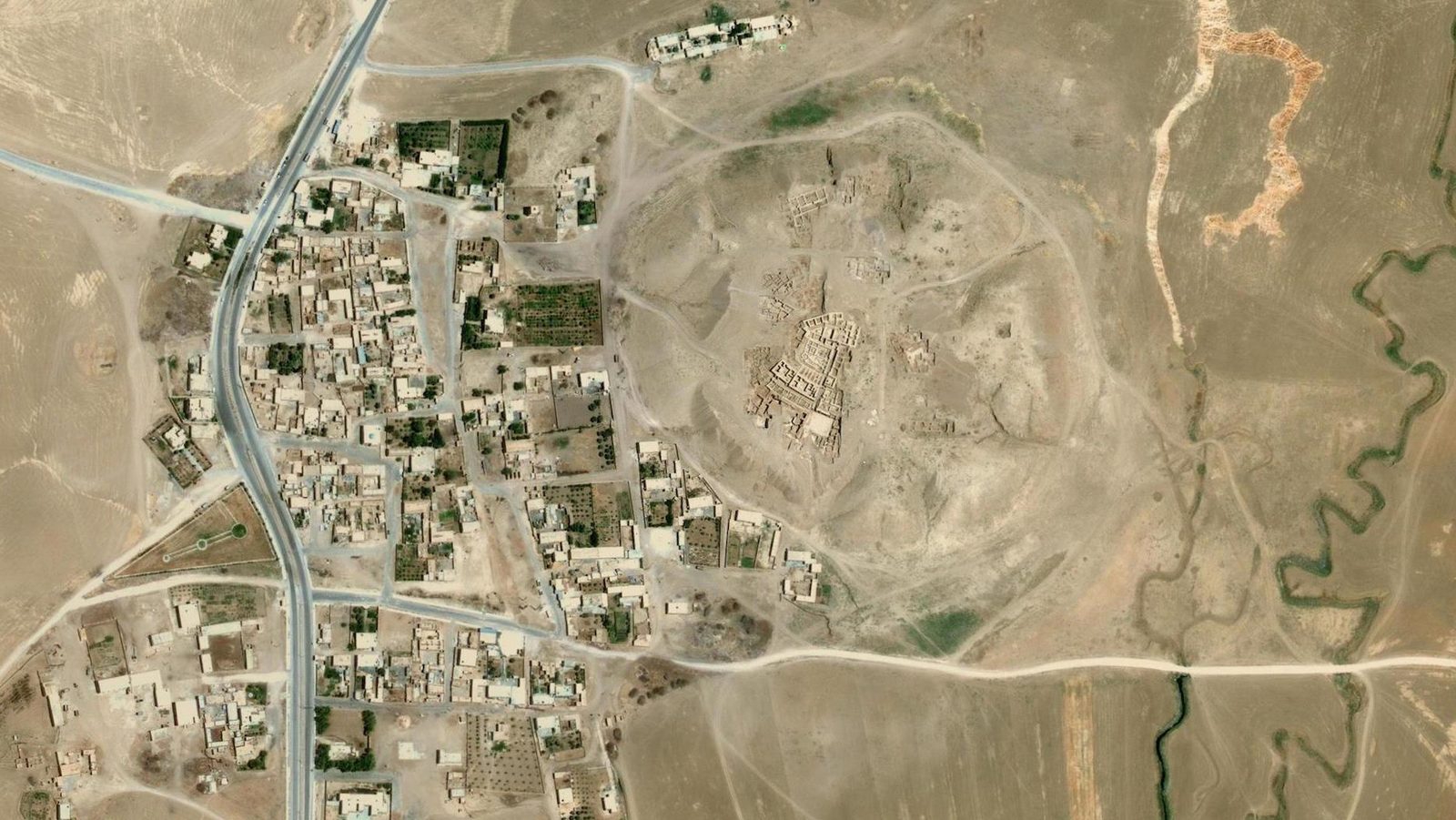
Aerial view of Tell Beydar and the modern village
Aerial view: the ancient mound at centre, the modern village of Tell Beydar adjoining from the west — the outer wall’s earth ring clearly visible.
6,000 years of history

The Nabada Timeline

From Chalcolithic villages to the Hellenistic palace, from Poidebard’s aerial photo to the last excavation season.

Archaeological landmarks

What did the picks uncover?

Two palaces, five temples, a main street, a residential quarter and walls — click any landmark for details and its map location.

Interactive map

Explore the village and ruins on the map

Real satellite imagery with the official 2010 excavation-areas map accurately overlaid on the mound. Switch layers and fade the archaeological overlay.

3D simulator

Walk through Nabada as it was in 2400 BCE

Interactive reconstruction of the Upper Town from the mission plans: walk Main Street, climb the basalt stair, enter the palace court and visit all five temples. Locations follow the true plan.

Current location
Outside the Upper Town gate
Head north toward Main Street.

🕹️ Start the tour

Click to enter. Move with W A S D or arrows, look around with the mouse, Shift to run, Space to jump, F for fly mode. Esc releases the cursor.

Enter the city
🚶 MovementWASD / arrows to walk, Shift to run. On mobile use the pad and drag to look.
📍 Quick travelBottom buttons jump straight to landmarks; the minimap shows your position (yellow dot) and view direction.
🦅 Fly modePress F or the fly button for a bird’s-eye view — Space up, C down.
🏛️ InfoApproaching any building shows its card (top corner) with the archaeological description.
Official virtual tour

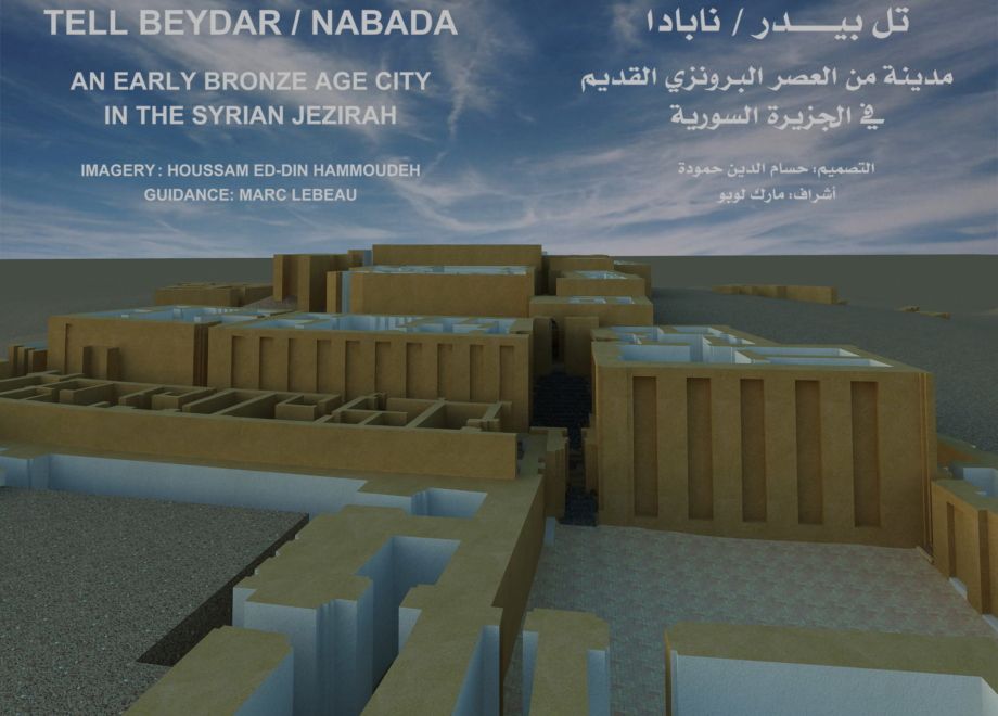
Mission 3D reconstruction (104 scenes)

The rendered series prepared by the Syrian–European mission for Nabada, from the air and ground level — divided into chapters with English narration.

1 / 104
Virtual tour

Nabada — 3D reconstruction

Pick a scene from the strip or chapters.

⚠️ Full image failed to load
Finds & discoveries

What made Nabada exceptional?

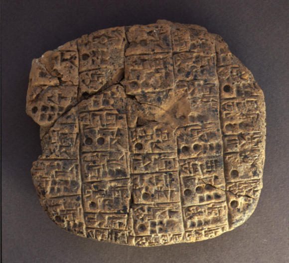
Cuneiform tablet from Tell Beydar
“Sheep for shearing: rams of Lushalim: one hundred; ewes: one hundred and eighty-five; three goats; grazing lambs: forty-three. Month of the sun god.”
— Model text from the Nabada archive (~2400 BCE) in the local Akkadian dialect. The tablets record workers’ food rations, herd accounts and official transactions, noting that the lord of Nagar came to Nabada to offer to Shamagan, “king of animals”.
Syrian–European mission

Eighteen years of joint work

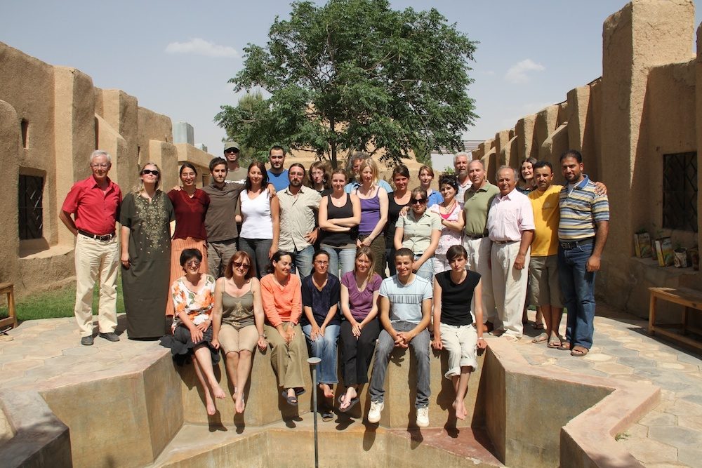
Tell Beydar mission team, 2010

The mission was organised by the European Centre for Upper Mesopotamian Studies (ECUMS) with Syria’s Directorate-General of Antiquities and Museums. The European side was directed by Marc Lebeau, the Syrian side by the late Antoine Suleiman from 1995 (Hamadeh Hamadeh in 1994); Abdul Masih Baghdo took administrative charge in 2005.

Between 1992 and 2010, 17 excavation and 7 architectural-restoration seasons were held. Most scientists and students worked as volunteers, so the European summer break set the season: late August to late October.

Since 2003, at the DGAM’s request, a major EU-backed restoration programme rebuilt the official buildings from their ancient foundations using only traditional materials: soil, water, straw, mudbrick, baked brick, white and grey plaster, stone and gravel.

Free University of BrusselsCatholic University of LeuvenCa’ Foscari University — VeniceLMU MunichMünster UniversityAutonomous University of MadridCoimbra UniversityOriental Institute — ChicagoLille III University
Marc LebeauEuropean director — ECUMS
Antoine SuleimanSyrian director (1995–2005) — DGAM
Abdul Masih BaghdoSyrian administrator since 2005
Joachim BretschneiderMünster/Leuven — “Nabada: The Buried City”
Lucio MilanoVenice — Northeastern Gate
Walther SallabergerMunich — cuneiform texts